Student postings for the 2025 Summer Season
SWI has as usual submitted an application to the Canada Summer Jobs Program for funding for FIVE positions working with us from late June to the end of August. We are looking for energetic, self-reliant and environmentally conscious students who would enjoy working in Strathcona Provincial Park, in the capacities listed below.
Please note that we will not know until April whether our application has been successful. However, we list our potential positions (subject to funding) below and encourage those interested in working for SWI to contact us to have their names on our list of potential candidates. Since we have received funding from the CSJ Program for the past 10 years we are confident that we will be successful.
- Visitor Information Counsellor at Paradise Meadows (Accepting Applications)
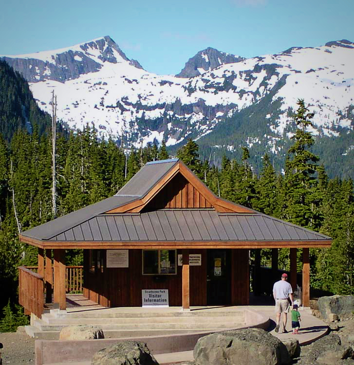
Strathcona Wilderness Institute (SWI) is looking for an enthusiastic and energetic person with an interest in working with the public in a park environment. They will assist with staffing at the Strathcona Park Wilderness Centre (managed by SWI) at Paradise Meadows in Strathcona Provincial Park and help the SWI Programs’ Coordinator. The Visitor Information Counsellor position will be 35-40 hours per week, for 8 weeks during the period from beginning July to late August. The rate of pay is $21 per hour. For full details please see the linked PDF.
- Visitor Information Counsellor at Buttle Lake (Accepting Applications)
Strathcona Wilderness Institute (SWI) is looking for an energetic outdoor-loving young person with an interest in working with the public in a park environment. They will staff the Buttle Hut, beside the Park HQ at Buttle Lake, Strathcona Park (on Westmin Road, off Highway 28). The position will be 35-40 hours per week for 8 weeks, July–August. The rate of pay is $21.00 per hour. The Buttle Lake Hut is beside the BC Parks Headquarters at Buttle Lake, Strathcona Park (on Westmin Road, off Highway 28). The assistant is expected to arrange their own transportation; accommodation is in the form of camping or a cabin at the Park HQ, with access to facilities (cookhouse, shower etc.) or else driving from a base in Gold River or Campbell River (approx. 45 k away). The Buttle Lake Hut is in a remote location without access to power or cell service (limited Wi-Fi may be available at Park HQ). For full details please see the linked PDF.
- Naturalist Interpreter/Research Assistant – 2 Positions (Accepting Applications)
Strathcona Wilderness Institute (SWI) is looking for two enthusiastic and energetic students with an interest in working in Strathcona Park. The students will assist in SWI’s Research and Educational programs that focus on the protection of the environment in Strathcona Park, primarily in leading our interpretive walks/hikes as well as contributing to SWI’s Floral and Faunal Inventories to monitor diversity and conservation issues in the Park. The positions will be 35-40 hours per week for 8-10 weeks late June to end August. The rate of pay is $21.00 per hour. For full details on the position please see linked PDF.
- Environmental Program Coordinator (Accepting Applications)
Strathcona Wilderness Institute (SWI) is looking for an enthusiastic and energetic student with a strong interest in working in Strathcona Park. The student will assist in the coordination of educational and research programs that focus on the protection of the environment in Strathcona Park, both in the Forbidden Plateau and Buttle Lake areas in Strathcona Provincial Park. The position will be 35-40 hours per week for 8-10 weeks late June to end of August. The rate of pay is $22.00 per hour. For full details on the position please see linked PDF.
For further information on the specific requirements of the positions please email us at strathconawilderness@gmail.com.
Applications
To apply, please send a resume, recent transcript and cover letter referencing the specific position in which you indicate how you meet the requirements for this position to:
Judy Norbury, Chair of SWI Board
Email: judynorbury@shaw.ca