HAPPY 115th BIRTHDAY STRATHCONA PROVINCIAL PARK

IN THIS ISSUE
- STRATHCONA BC’s FIRST PROVINCIAL PARK – March 1, 1911
- CONDITIONS IN THE PARK
- UPCOMING EVENTS : VIMFF. & SWI AGM
STRATHCONA PROVINCIAL PARK - MARCH 1, 1911
In 1911 Premier Richard McBride established as BC’s first Provincial Park the triangular area surveyed in 1909 by Price Ellison and called “Strathcona Reserve”. The name honoured Sir Donald A. Smith, who was created 1st Baron of Strathcona and Mount Royal in 1897 on Queen Victoria’s Diamond Jubilee Honours list. Originally the new Park covered 105,937 ha within a right-angled triangle imposed on the map of the centre of Vancouver Island, with the apex at more or less at Gold Lake, its hypotenuse running south east along the boundary of the E. & N. Railway Land Grant to just north of the east end of Great Central Lake. The lines did not exactly take actual topography into consideration. The initial area included the natural Buttle Lake (now a “reservoir” created by the 1955 Strathcona Dam) and the mountain ranges to the west and south of it.
The figure below illustrates the outline of the original triangle superimposed on a map that post-dates the Strathcona Dam that created the present Lower and Upper Campbell Lakes and raised the level of Buttle Lake.

A 1921 pamphlet from the Ministry of Lands eloquently describes the stunning landscapes of the new Park as a wonderful place for summer vacations, ignoring the difficulties of access. In 1921, ten years after its creation, the dirt trail past McIvor Lake to what is now Buttle Narrows was barely passable for an automobile. However, the sheer number of tantalizing peaks naturally attracted mountaineers and so in 1912 an expedition of the Alpine Club of Canada, organized by A.O Wheeler (land surveyor and co-founder ACC), with his son E. Oliver Wheeler leading the group of nine climbers, made the first ascent of what had been nicknamed the Matterhorn of Vancouver Island and formally named it Elkhorn Mountain.

In order to reach a base camp at the Drum Lakes and Elk River Valley, the group, together with government officials and guides, travelled by a combination of pony and canoe transportation, as well as on foot, from McIvor Lake by way of the Campbell River, Lower and Upper Campbell Lakes. Some members of the group continued after Elkhorn on a 5-day trek by way of Price Creek and Price Pass to the southern boundary of the Park, passing Oshinaw and Elsie Lakes and on to Port Alberni. Arthur Wheeler in his article in the Canadian Alpine Journal vol. 5, 1913, concludes that “Strathcona Park is a splendid possession”, foreseeing a great future for alpine expeditions. [The 1913 CAJ articles by Arthur Wheeler and his son Oliver can be found as Chapters I and 2 of Linday Elms’ “Above the Bush – a Century of Climbing on Vancouver Island 1912-2012.” (Misthorn Press, 2012.)]
While the original intent in the creation of the Park was to offer something to rival the National Parks in the Rockies, the rich natural resources of the area resulted in a chequered history of the conflicting demands of nature and industry. Over the century of its existence the Park saw changes back and forth in classification (to permit a range of logging and mining activities), additions and subtractions of land, as well as the first major environmental protest in BC in 1988/89. A full account of the Park’s transformations is given in Catherine Gilbert’s “Journey Back to Nature – A History of Strathcona Provincial Park” (Heritage House Publishing, 2021).
Through its first 60 years additions increased the area up to 215,024 ha (close to the present 250,000 ha.) One addition to the Park, promoting its recreational purpose, was the 1967-8 inclusion of the Forbidden Plateau area with its jigsaw-like boundary line. This area of private land (originally within the E. and N. land grant and owned in the 1960s by Pacific Logging) was accessible from the Comox Valley and had drawn outdoor sports enthusiasts, summer and winter, since the 1930s. The new boundary now incorporated the subalpine plateau with its many lakes, as well as the alpine terrain from the Comox Glacier north to Mt Albert Edward and Jutland; it did not include the timbered Cruikshank River valley and borders of Comox Lake, which would have served as protection for the watershed supplying the Comox Valley.


Today, the areas that are most heavily used as a result of the ease of road access to established trails and campsites are the Forbidden Plateau and the environs of Buttle Lake, which are clearly considered “recreational” space. The Buttle area includes those peaks along the Elk River corridor, such as Elkhorn Mountain, accessible from Highway 28. The so-called Matterhorn of Vancouver Island can be ascended in just under 24 hours of “extreme” climbing, a trip that in Wheeler’s time took several days from Campbell River. Other areas within the 250,000 ha of the Park are still reserved as “untouched wilderness”, where access is restricted by remoteness and lack of defined routes, but as hiking boots push further and further from the core zones, the boundaries of “pristine, untouched wilderness” are shrinking.
Far North Visuals of Campbell River has recently released a series of 9 videos produced by Grady Robertson and his team, based on interviews with people associated with the Park in a variety of contexts. This project, under the general title “Secrets of BC’s Oldest Park Revealed”, was supported by Telus STORYHIVE. Click here for the Youtube series.
Listed below are the titles and people interviewed in the nine videos; the content ranges from background history, issues past and present, and the different ways in which the Park is now used.
- S1 Ep 01 Friends of Nature
- Marlene Smith & Kel Kelly of FOSP
- S1 Ep 02 Base Camp: Strathcona Park Lodge
- Jamie Boulding & Catherine Gilbert
- S1 Ep 03 Call to Adventure
- 2 Outdoor Programmes (Timberline and COLT)
- S1 Ep 04 Risk and Reward
- Jan Neuspiel of Island Alpine Guides and CR SAR
- S1 Ep 05 Ark of Biodiversity
- Loys Maingon Research Director of SWI
- S1 Ep 06 Community Action
- Loys Maingon and Zeke Gilmore of SWI
- S1 Ep 07 Writing History
- Lindsay Elms, alpinist and historian, of SWI
- S1 Ep 08 Island Winter
- filmed by Grady Robertson and Noah Vaton
- S1 Ep 09 The Heathens
- Chris Barner, climber and leader of the Heathens
CONDITIONS IN THE PARK
After a dismal dearth of snow through January and most of February, in the last week of that month the Park and Mt Washington received over a metre – enough to allow some of the Nordic trails in the Park to be groomed and on Mt Washington the slopes no longer showed protruding rock, to the delight of the deprived ski and snowboard enthusiasts. And the Comox Glacier received a fresh new mantle as in the photo below taken on March 2nd across the Lake from the Comox Lake Bluffs Eco-Reserve.

However, into March the “pack”, such as it was, has been diminishing, so that the Nordic trails in the Park are again closed, with a snow depth of only 75 cm. Further precipitation is certainly needed, and especially so that the snow lingers on into May to feed the water table in the valley with an adequate spring melt to delay the inevitable drought conditions in the coming summer months.
Over in the Buttle the peaks did benefit from fresh snow to become gleaming white in the sun and even at lake level the snow was lingering along the shore in late February and the lower elevation trails still had a crusted white covering.

Nonetheless in the warmth of the sun at Karst Creek a grouse could be heard drumming in the trees above the lake.
Finally, an update on the access to the Bedwell trail: the Jim Mitchell Lake road is passable at the washout location, but it will only be properly rebuilt once conditions are drier.
UPCOMING EVENTS
VANCOUVER INTERNATIONAL MOUNTAIN
FILM FESTIVAL 2026
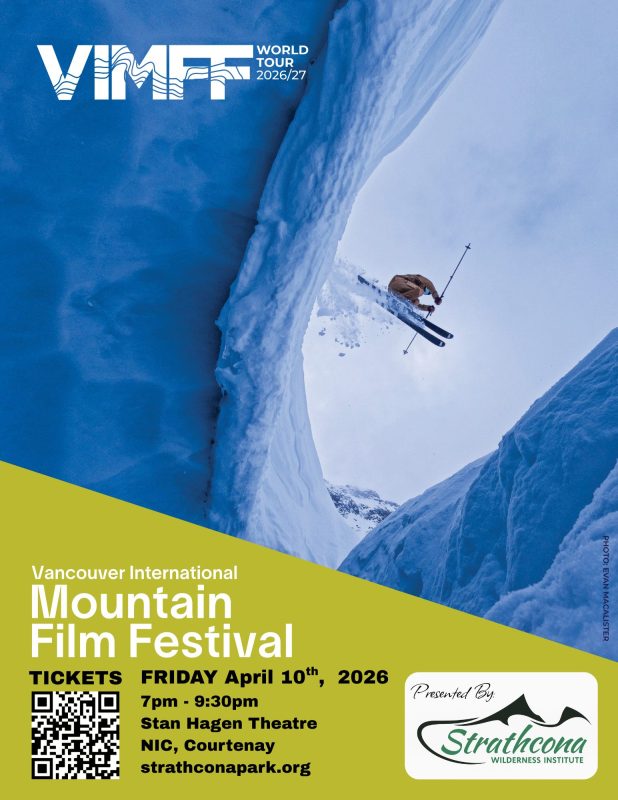
Date: Friday April 10th, 2026
Time: 7pm – 9:30pm (Doors Open 6:30pm)
Location: Stan Hagen Theatre, North Island College, Courtenay.
Tickets: Adults $20 Online, $25 At the Door
$15 Student (Valid ID) and Youth (16 & Under)
Purchase Tickets: Online through Simpli Events.
Strathcona Wilderness Institute is delighted to host once again the Vancouver International Film Festival (VIMFF) now in its 29th year. The program will as usual feature some of the best thought-provoking and action-packed films about climbing, snowsports, biking, the environment and more, created by BC, Canadian and International filmmakers.
We will select approximately a total of 2 hours of some the best films from this year’s VIMFF 2026 lineup, generally 8-12 individual films and will post the finalized film line-up on our website closer to the event. There will be a 15-20 min Intermission halfway through the show, after which there will be a draw for some fine door-prizes generously donated by local businesses.
To see previous years VIMFF film lineups visit our Past Events page at: https://strathconapark.org/past-events/
SWI 2026 AGM & Presentation – April 22nd
Date: Wednesday April 22nd, 2026
Time: 7:00pm – 9:00pm
Location: Evergreen Lounge, Filberg Centre, Courtenay
SWI will hold its Annual General Meeting on April 22nd in the Evergreen Lounge of the Filberg Centre at 7:00 pm in conjunction with a presentation by Eryn Tombu-Haigh on her ascents of all 53 of the “6000 ft” Peaks on Vancouver Island.
Strathcona Wilderness Institute is a not-for-profit organization whose essential role is, in partnership with BC Parks, to serve as an interface between the Strathcona Wilderness and the general public. We are a non-membership society, and so we invite members of the public with an interest in Strathcona Provincial Park to attend our AGM, since its purpose is to present our Annual Report to the public, as well as to elect the Board of Directors for the coming year.
With our mission to inspire awareness, appreciation and stewardship of the Natural World through research, education and participation, we schedule interpretive hikes and workshops, and oversee research projects in the Park, including the SWI Data Collection Project on iNaturalist. We also provide the public with information about the Park at our two “huts” each summer in Strathcona Provincial Park, at the Paradise Meadows Trailhead and at Battle Lake. All our activities are carried out by VOLUNTEERS and SUMMER STUDENTS (with funding from the Canada Summer Jobs program and BC Parks Foundation).
We invite former and potential volunteers to attend the AGM and learn more about SWI’s work, accomplishments and plans for the upcoming year. We always welcome volunteers to staff our visitor centres and participate in our educational programs, thus ensuring the continuation of what we have achieved in the past. Please put your names forward! Moreover, anyone who loves Strathcona Park and would like to contribute a little of their time to the organization of SWI’s many activities should consider becoming a director. We have two vacant spaces on the Board. Nominations can be made in advance or from the “floor”.
OUR GUEST PRESENTATION
The presentation will feature Eryn Tombu-Haigh illustrating her personal quest to climb all 53 of the 6000 ft peaks on Vancouver Island. Eryn grew up in a rural community, hiking everywhere, without particularly focussing on mountains, but the attraction of open, uninhabited spaces with limitless views, drew her higher and higher, so that she eventually discovered she had in fact climbed all but five of the 53 peaks. It therefore made sense to complete the remaining few, which she did by 2022. Through her photos she will share her experiences on many incredible trips. And now her passion for climbing has been picked up by her seven-year old son, Caleb, who accompanied her on an ascent of the Golden Hinde last summer, and so their climb together to the top of the Park’s highest peak will also be featured in this presentation.


For more information about the AGM or our Presentation
please contact us at: strathconawilderness@gmail.com
PS – One more “Canadian Bird” in the Park
Sitta canadensis – Red-breasted Nuthatch

This colourful little bird was searching for its lunch cache on a cedar snag in the warmth of February’s sunshine in Paradise Meadows.